Nagoya is Japan’s fourth largest city, best known for its industrial prowess. During the pre-industrial Tokugawa Period (1603-1868), Nagoya was a strategic castle town and a major crossroads of several of Japan’s historical roadways. But Nagoya’s history stretches back two millennia, as it is also the home of one of Japan’s oldest major Shinto shrines. This is a half-day walk exploring several diverse aspects of this long history and the culture that it created.
Check out the map for your walk here.
Begin from Nishi Takakura Station on the Meijo subway line and walk south. A little over 200 meters down on the right hand side is the entrance to Atsuta Park, a green space that was once part of the historically expansive grounds of Atsuta Shrine, the last stop on this walk.
Atsuta Park is now principally playing fields (a baseball diamond and a soccer field), but its southeast corner is dominated by what appears to be a heavily wooded hill surrounded by a stone-lined dry moat. This “hill” is Danpusan Kofun, a 6th century keyhole-shaped burial mound. The kofun stands 15.1 meters tall and is believed to contain the remains and possessions of a local chieftain of the time (it has never been opened/excavated). According to a sign, there was a time when people were permitted to climb the hill (only one day of the year, March 3) and the summit afforded excellent views to the nearby waterfront. These days the kofun is a designated national treasure and ascent is prohibited. Perambulate the perimeter (or at least the northern and western sides of it) to get a feel for the keyhole shape.
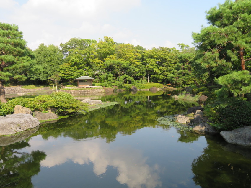
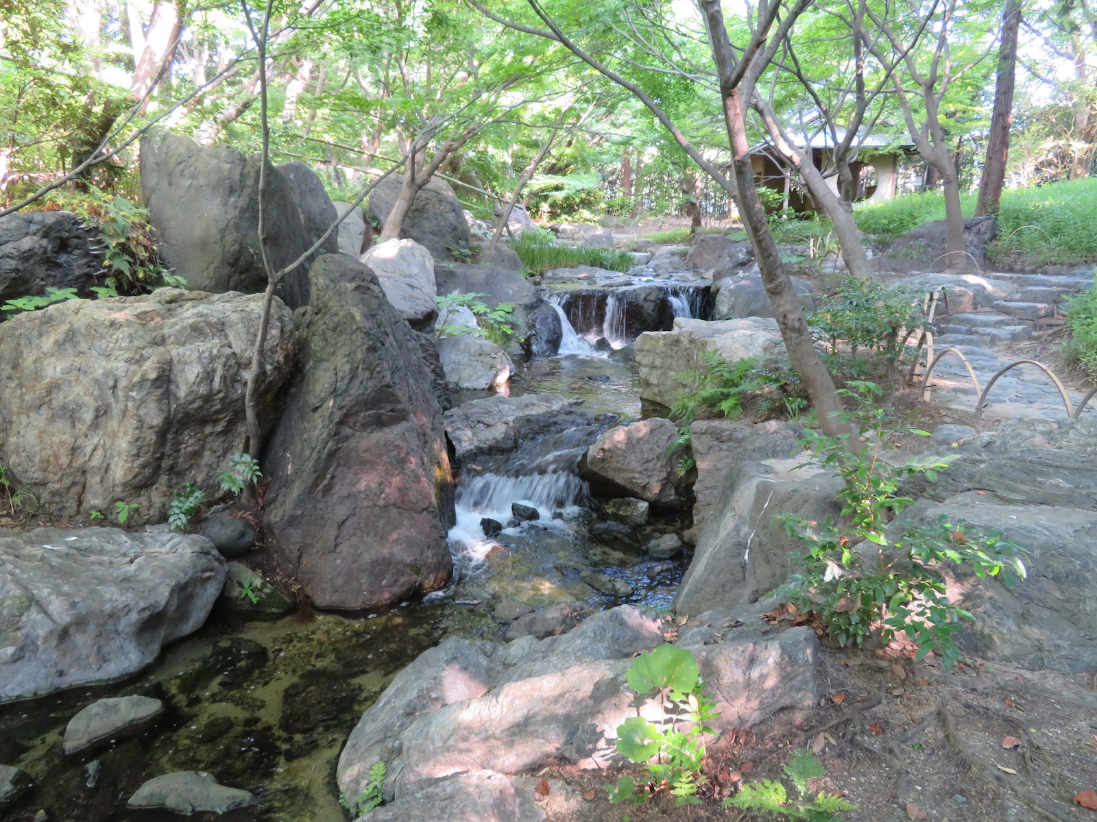
Leave the park from the southwest corner of the kofun and walk to the nearby Hori River. Cross the river using the pedestrian bridge about a hundred meters downriver to reach the north gate of Shirotori Garden (Hours: 9 a.m. to 5 p.m., closed Mondays; admission: 300 yen). This traditional-style Japanese strolling garden is a beautifully designed homage to the Kiso River system that waters this region. The pond that dominates the northern part of the garden represents the Ise Bay and the elevated southwestern part of the garden represents Mt Ontake, where the Kiso River rises. Move counterclockwise around the garden to follow the river to its source, a refreshing series of waterfalls.
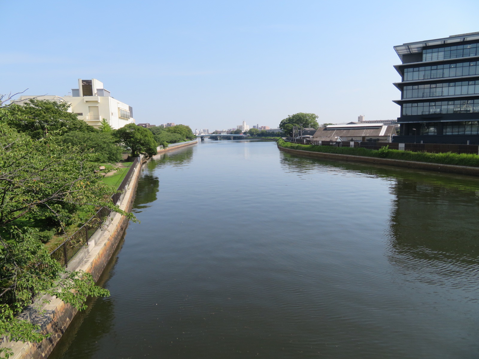
After exploring Shirotori Garden, leave the garden by its main gate (south end of garden) and continue to walk downriver, this time using the riverside “promenade” that leads under Shirotori Bridge and then alongside the river. Like most urban rivers in Japan, the Hori River is encased in concrete to facilitate flood control. It is also tidal in this area. Much of the area along the opposite bank is parkland, giving strollers some green scenery. About halfway between Shirotori Bridge and Oseko Bridge a stone marker on the right memorializes the air raids Nagoya suffered in the winter of 1944-45 that particularly devastated this part of the city. As a result of the air raids, nearly 3,900 people died and more than 470,000 were displaced.
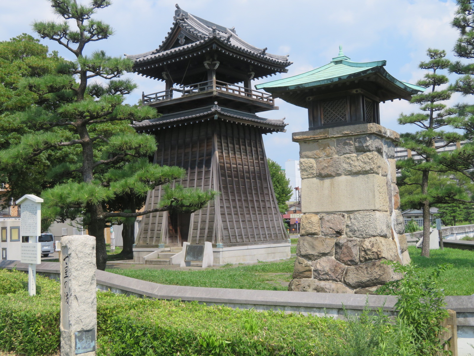
Cross Oseko bridge and continue downriver. This area is the former site of Miya-juku, the 41st of the 53 post towns on the Tokaido Road that carried travellers between Edo (modern Tokyo) and Kyoto during the Tokugawa Period. Little remains of the post town, which took its name of Miya (meaning “shrine”) from its proximity to the venerable Atsuta Shrine. Miya-juku was also the starting point of the Minoji, a road connecting the Tokaido and Nakasendo roads as well as of the Saya Kaido, a minor deviation of the Tokaido. Many Tokaido travelers preferred to travel by boat between Miya-juku and Kuwana-juku to the west. Commemorating this is a little waterfront park containing explanatory signs and reconstructions of the boat pier and the lighthouse that guided boats back in the day. The original lighthouse was built on this site in 1625; the reconstruction dates to 1955.
From this little park, turn your back to the river and head north. After a couple of minutes, pass by Hoshoin, the temple charged with lighting the lighthouse light for two and a half centuries, until 1891. Then turn right onto the 6 lane Fushimi-dori and use the second pedestrian bridge to cross from the southwest corner to the northeast corner of the intersection, continue north and take the first right, just past Paperhouse, a papercraft/art supply shop.
Ahead on the left is the main entrance to Atsuta Shrine, marked by a large cedar torii.
Atsuta Shrine was founded over 1,900 years ago to house Kusanagi no Tsurugi, the sacred sword that is regarded as one of the three great treasures of the Imperial House of Japan (the other two are the sacred mirror kept at Ise Grand Shrine and the sacred jewel kept at the Imperial Palace in Tokyo). These three great treasures, also sometimes referred to as the Imperial Regalia, have been used in imperial enthronement ceremonies since the 7th century. Needless to say, the sword was removed to Tokyo for the recent ceremonies relating to the abdication of the Heisei emperor and enthronement of the Reiwa emperor.
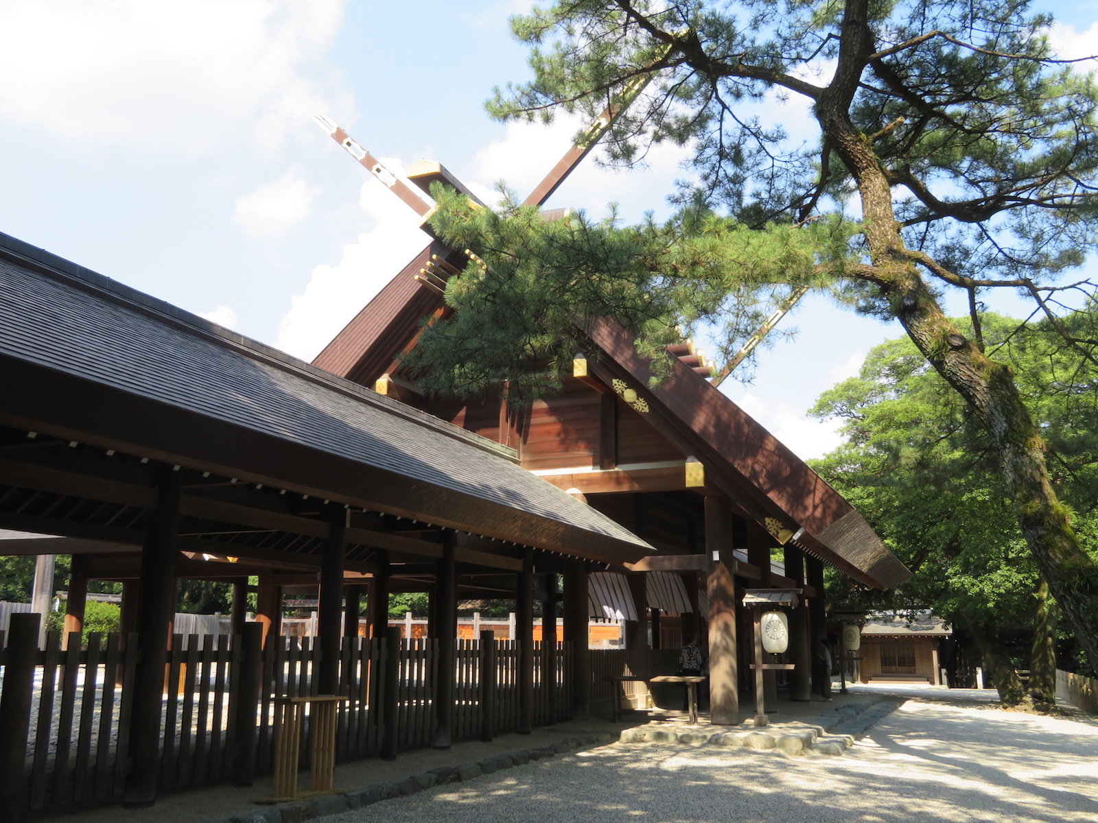
Atsuta Shrine’s age and size make it one of the most important shrines in Japan, on a par with Ise Grand Shrine. The heavily wooded grounds are extensive, even today, in spite of significant portions of its land having been given over to urban development after World War II. The grounds are host of a number of subordinate shrines as well as the main shrine itself. Interspersed with the trees are massive stone lanterns and stone bridges arching over narrow canals. There is a pond in the central western section, with a small cafeteria overlooking it, well known for its soba noodles.
Over the centuries, the shrine has been patronized by many of Japan’s most famous historical figures. Reflecting this long history, the shrine’s Treasure House is a museum with over 6,000 manuscripts and artifacts. The Treasure House is open 9 a.m. to 4:30 pm (closed the last Wednesday of the month as well as for a few days just before New Years).
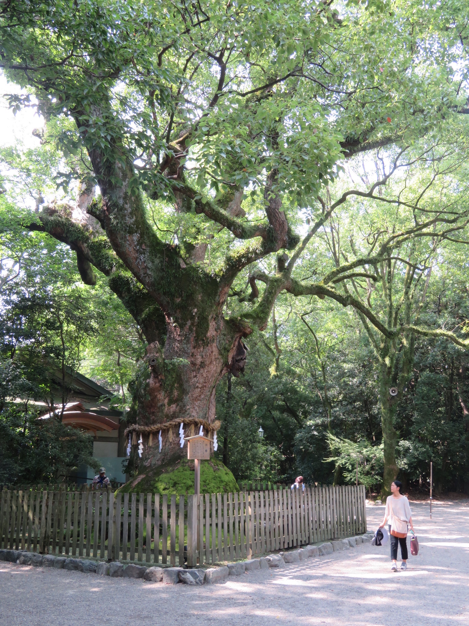
Across from the Treasure House is a massive camphor tree said to have been planted by the great Buddhist priest Kobo-daishi (774-835). A little further up the lane leading to the main shrine is a two meter high wall made of layered clay tiles that was built by the warlord Oda Nobunaga (1534-1582) in 1560 to thank the gods for victory in battle. Apparently the original wall was over 400 meters long and surrounded the main shrine; only 120 meters of it remains today.
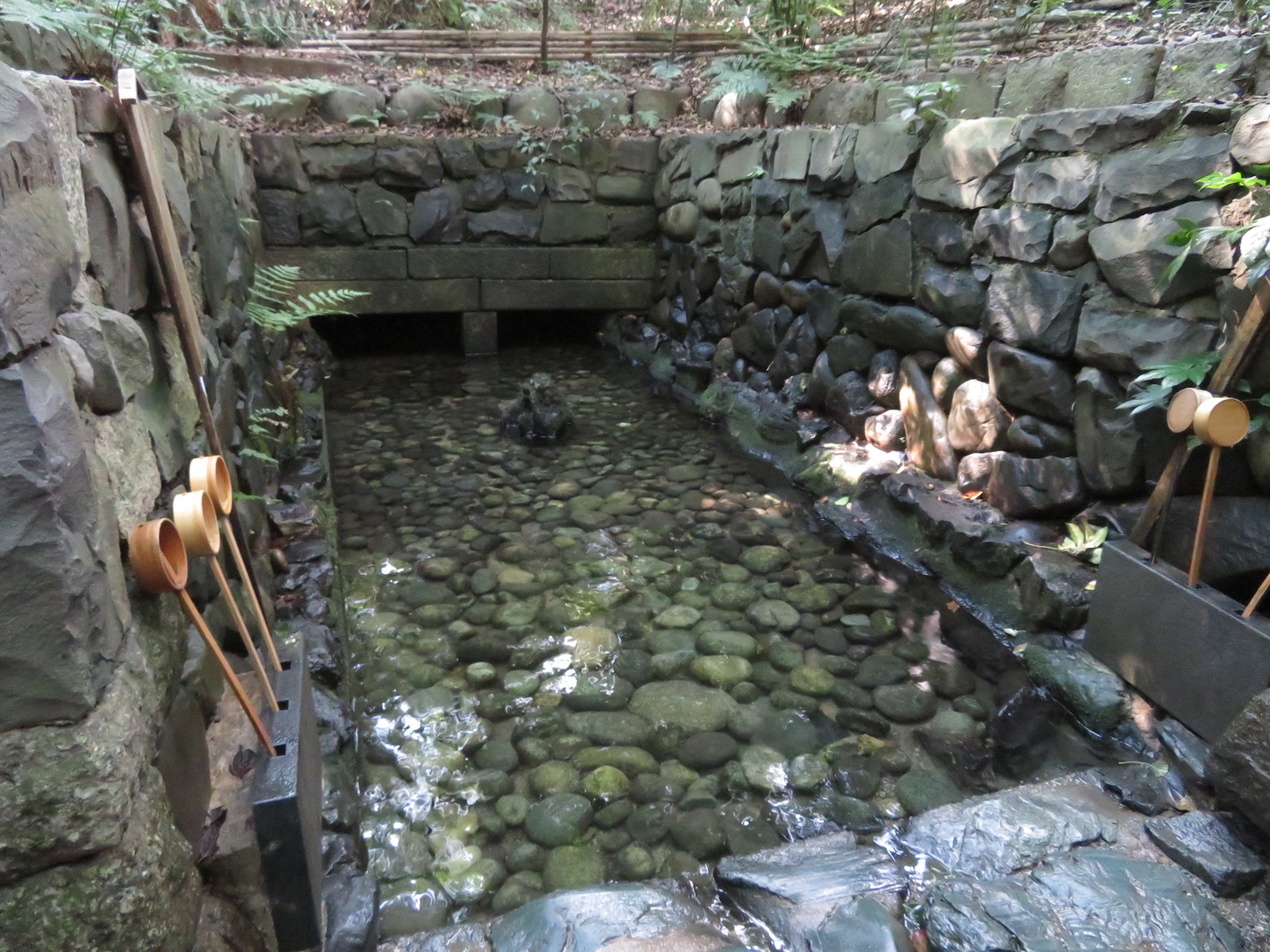
The main shrine, destroyed in World War II and reconstructed in 1955, is in the same architectural style as the shrines of Ise, with which it is so closely related. A narrow path to the right of the administrative buildings next to the main shrine leads around to the back of the shrine, where there is a spring containing pure water. Among the miracles attributed to this water is curing the blindness of a samurai in ancient times. It is also said that washing one’s face with this water will produce beautiful skin. More recently, it is believe that hitting a stone protruding from the center of the pool with a bamboo scoop of the water three times will result in one’s wish coming true. In any event, it’s a pretty little pool worth checking out. The path continues right around the back of the shrine and is a shady, peaceful stroll.
The entire shrine ground is shady and peaceful and one could spend hours trying to explore its various nooks and crannies. When finished, departing on the west side of the shrine, it is a seven- minute walk to Jingu Nishi Station on the Meijo subway line. Or leave the shrine to the east side for a three-minute walk to Jingu-mae station on the Meitetsu train line.
Vicki L Beyer, a regular Japan Today contributor, is a freelance travel writer who also blogs about experiencing Japan. Follow her blog at jigsaw-japan.com.
© Japan Today


No Comment
Login to comment